## Accommodation in Smithfield
The accommodation scene in Smithfield is small and personal. Online listings for the town are currently minimal, with prices not formally catalogued across booking platforms, which means the experience of finding a place to stay here differs from better-known destinations. Visitors planning a trip typically look to locally operated guesthouses and farm stays, which have long been the backbone of hospitality in the southern Free State. Direct contact with operators, rather than online search, often surfaces the best options.
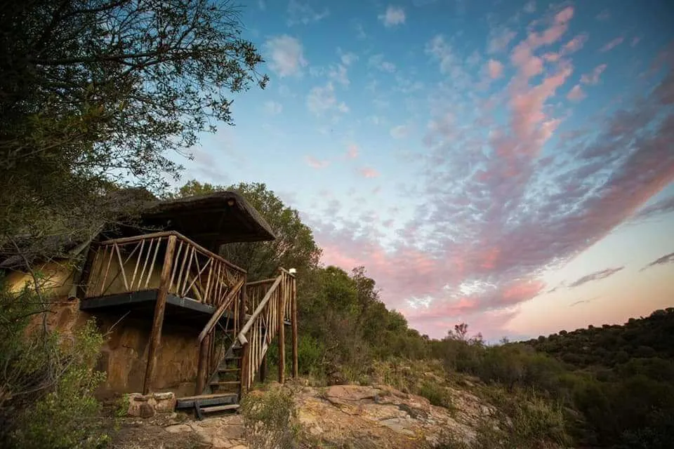
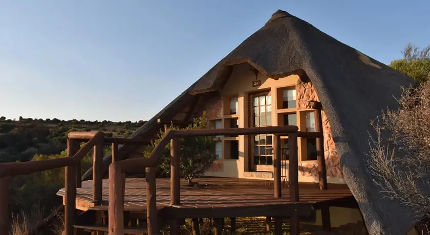
At the budget end, self-catering cottages and rooms within working farm properties give travellers a practical base without much ceremony. Facilities tend to be clean and functional, with owners often willing to advise on local roads, birding spots, and driving conditions in the district. This tier suits travellers who want shelter and a kitchen rather than service, and the pricing reflects that simplicity.
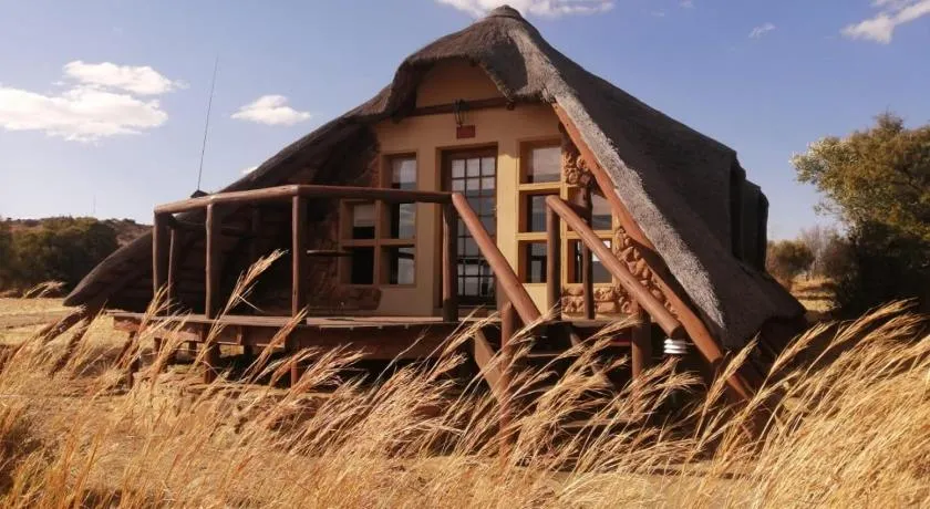
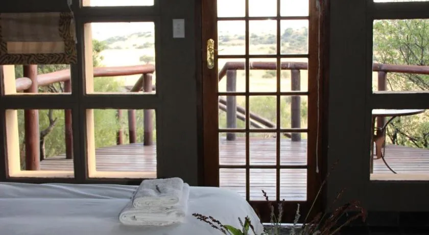
Mid-range options step up to more comfortable guesthouses, usually offering breakfast and sometimes an evening meal, in either the town itself or on surrounding farmland. The experience at this level leans toward the personal rather than the polished. With small guest numbers, hosts can give individual attention that a larger establishment would not manage, and conversations over breakfast often turn into useful local knowledge for the day ahead.
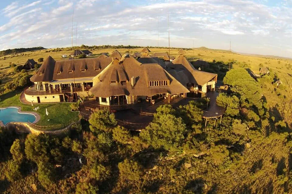
Upper-tier accommodation in and around Smithfield is not the defining feature of the destination. Travellers seeking high-end game lodge facilities or resort-style amenities would find more options further afield. What the area offers instead is a kind of understated authenticity that suits visitors who want contact with everyday rural South Africa rather than a packaged product.
Farm stays in the wider district deserve particular mention. Several properties operate as working agricultural concerns where guests can observe or participate in farm routines, which appeals to visitors drawn to the landscape and pace as much as to any specific attraction. Booking directly, or through the local municipal tourism contacts, remains the most reliable approach when planning a stay in the area.
## Best Time to Visit Smithfield
The southern Free State has a dry, semi-arid climate shaped by its position on the Karoo fringe. Summers run from November through February and bring warm to hot days, often with late-afternoon thunderstorms that clear quickly and leave the air sharp and cool by evening. January temperatures can exceed 35 degrees Celsius, making midday activity uncomfortable, though mornings and evenings remain very pleasant. The summer rains produce a brief flush of green across the otherwise tawny landscape.
Winter, from June through August, is dry and cold. Overnight temperatures regularly fall below freezing, and mornings can be sharp, but days are clear and sunny with warmth returning by midday. The combination of cold nights and cloudless skies makes winter the best season for stargazing, which is one of the area's genuine draws given the minimal light pollution across this stretch of the Free State interior.
Autumn and spring, particularly April, May, and September, offer the most balanced conditions: mild temperatures, lower rainfall, and better birding as migrant species move through the Karoo fringe. These shoulder periods also see less traffic on regional roads. There is no formal high season in Smithfield, though South African school holiday windows in June, September, and December bring increased movement on the N26 and surrounding routes, so booking ahead during those periods is worth doing.
## Getting to Smithfield
Smithfield sits on the N26 highway, which links Aliwal North in the Eastern Cape with Springfontein and the central Free State to the north. Drivers coming from the Western Cape or the Garden Route typically approach via the N9 or N10 through the Karoo, joining the N26 at or near Burgersdorp. From Bloemfontein, the drive south covers approximately 200 kilometres and takes roughly two to two and a half hours across open plains. Travellers from the Eastern Cape interior, coming through the Stormberg or via Queenstown, can reach Smithfield from Aliwal North in under two hours.
The nearest commercial airports are in Bloemfontein and East London. Bloemfontein's Bram Fischer International Airport is around 200 kilometres to the north and handles domestic routes from Johannesburg and Cape Town. East London Airport, roughly 280 kilometres to the southeast, offers similar domestic connectivity. International arrivals almost always connect through OR Tambo International in Johannesburg before picking up a domestic leg.
There is no scheduled public transport serving Smithfield directly. Minibus taxis run between regional towns on fixed informal routes, but these are not practical for visitor planning. A private vehicle is genuinely essential for any stay in the area. Main routes are tarred and in reasonable condition, but access roads to farms and outlying properties are typically gravel and can become difficult after heavy summer rain. A standard sedan manages the main roads without difficulty; a vehicle with higher clearance is useful for extended farm exploration.
## Smithfield and Surrounding Areas
The countryside around Smithfield is thinly settled farming land, and the nearby places on the map are mostly small rural communities or named farm districts rather than formal tourist nodes. Each has its own character that is worth understanding for visitors considering day excursions or a multi-night itinerary across the region.
**Pieterskop**, 24 kilometres from Smithfield, takes its name from a prominent hill, or koppie, visible from the surrounding plains. The area is mixed Karoo farmland and draws visitors interested in the open, uncluttered landscape and the geological character of the region's rocky outcrops. The koppie itself is a navigational landmark that has oriented travellers across this flat terrain for generations.
**Venter Fontein**, 25 kilometres out, translates loosely as Venter's Spring and reflects the settler history of the area. Water sources in the Karoo fringe defined where farms were established, and this locality is a trace of that pattern. The area is flat and dry, and the surrounding land gives a clear sense of how the agricultural history of the southern Free State unfolded.
**Groenpoort**, at 33 kilometres, means Green Gate and likely refers to a drainage line or low point in the terrain where seasonal vegetation was more reliable. Farm properties in this direction tend to be larger and more remote, which suits visitors who want genuine solitude rather than proximity to services.
**Groenvlakte**, 46 kilometres from Smithfield, sits further into the Karoo transition zone. The landscape here is drier and more sparsely vegetated than the immediate surroundings of Smithfield, and it gives a clearer impression of the true Karoo character that becomes dominant further south and west. Birdwatching in this direction can be rewarding for Karoo-specific species.
**Buffelsbadden**, at 51 kilometres, carries a name suggesting a historical water feature where buffalo watered or wallowed. Farm properties in this direction may have access to seasonal pools or natural water sources, and the area has a slightly more varied topography than the flat plains around Smithfield itself.
**Springfontein**, also 51 kilometres away, is the largest settlement in the immediate area and functions as a small service town with a notable railway history. The town sits on the main Cape to Johannesburg rail corridor, and remnants of its past as a significant junction are visible in the station infrastructure. For visitors needing a slightly broader selection of basic services, Springfontein is the most practical short drive from Smithfield.
## Planning Your Stay
Given the limited number of accommodation options around Smithfield, early contact with prospective properties is advisable. Unlike popular tourist towns where last-minute bookings are feasible, smaller guesthouses and farm stays operate with only a handful of rooms and can fill unexpectedly around public holidays and school breaks.
When comparing properties, ask directly what is included in the rate. Breakfast, dinner, firewood, and use of outdoor areas or braai facilities vary considerably between operators and are not always reflected clearly in online listings or informal directories. Farm stays in particular may have conditions around gate times, working areas, or pets that are worth establishing before arrival.
Check the road condition to your accommodation before setting out. Some farm properties are accessible only via gravel roads that become impassable after significant summer rain. This matters most between November and February, when afternoon thunderstorms can dump water quickly on already-dry ground.
Local tourism information is sometimes available through the Smithfield municipality directly, and hosts at local accommodation are often the most useful source of practical advice on the area. Mobile data coverage can be patchy outside the town, so downloading offline maps before departing is a sensible precaution. Fill up with fuel in Smithfield or a larger nearby town before heading into the surrounding district, as filling stations are not reliably available on rural routes.