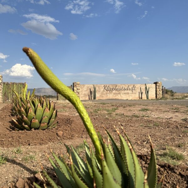
## Accommodation in Bonnyvale
Bonnyvale has no formally listed accommodation properties at present, a reflection of the settlement's size and its place within one of South Africa's most sparsely populated farming districts. Merino wool production forms the economic backbone of this stretch of the Northern Cape, and the people who live here are farmers and farm workers rather than hospitality providers. That context shapes what visitors should expect.
For those travelling on a budget, the most accessible option is typically a self-catering cottage or room attached to a working sheep farm. These informal arrangements are agreed directly with landowners, generally through local contacts or community networks, rather than through booking platforms. The experience is basic in terms of facilities but offers proximity to daily farm operations and a genuine sense of how the Karoo economy functions. Mid-range accommodation in the wider region takes the form of small guest farms and farm guesthouses, where hosts include meals and sometimes arrange walks or drives on the property. These cost more than a self-catering option, but the difference tends to show in local orientation: a farmer who has worked this land for three decades will give you a richer account of the landscape than any brochure provides.
For those who prefer more predictable comfort and reliable facilities, the nearest towns to the east offer a selection of properties with en-suite rooms, consistent electricity, and tarred road access. These work better as base camps for day trips into the Bonnyvale area than as standalone experiences.
Given that current listings total zero on mainstream booking platforms, visitors should approach accommodation research through direct contact with farm properties and guesthouses in the broader district, ideally well ahead of the planned trip. Farming communities do not operate on the same availability logic as tourist towns, and the remoteness of this region makes arriving without a confirmed booking a more serious problem than it would be elsewhere.
---
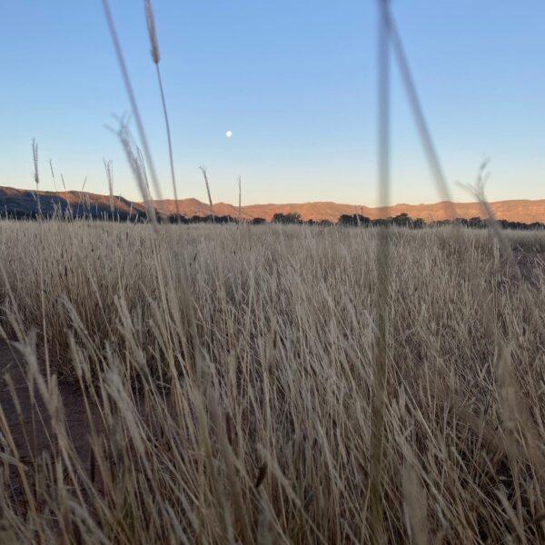
## Best Time to Visit Bonnyvale
The Northern Cape climate dictates when visits are most comfortable. Summer runs from November through February and brings intense heat, with midday temperatures regularly exceeding 35°C. Travel is possible during these months, but the conditions demand early morning activity and a vehicle with reliable air conditioning. Brief thunderstorms, though infrequent in this low-rainfall region, can quickly make gravel roads treacherous.
Autumn and spring offer the most moderate conditions. Between March and May, and again from September to October, daytime temperatures settle in the low to mid-twenties. The light is good for long walks and wildlife observation, and the landscape can show subtle shifts in vegetation after any recent rainfall, with spring bringing out the flowering succulents that punctuate the dry veld.
Winter, from June through August, brings cold nights and early morning frost across the higher ground. Days recover quickly once the sun rises, reaching comfortable temperatures by mid-morning. The dry air and complete absence of urban light pollution make winter the most rewarding season for stargazing. On a clear winter night, the Milky Way stretches from horizon to horizon, and the density of stars overhead can be genuinely disorienting for visitors accustomed to city skies. This alone draws some travellers to the Karoo at a time of year when others avoid it.
---
## Getting to Bonnyvale
Bonnyvale sits approximately 150 kilometres southwest of Aliwal North, which lies on the N9 and provides the nearest town of reasonable size for fuel, supplies, and overnight stops before or after the main journey. From Johannesburg, Aliwal North is roughly five to six hours by road via the N1 to Colesberg, then east along the N9.
Travellers arriving from the south should note that Burgersdorp, in the Eastern Cape approximately 60 kilometres to the southeast, is the closest point with a fuel station and general supplies for the approach into the Northern Cape farming country. The R56 and connecting regional roads link these small communities across considerable distances, and the drive between them passes through characteristic Karoo terrain with few services along the way.
No scheduled bus or coach routes serve Bonnyvale. A private vehicle is the only practical means of reaching the settlement and getting around once there. Standard two-wheel-drive vehicles manage the main tarred routes without difficulty, but gravel roads branching toward individual farms can deteriorate after rain and may demand more ground clearance than a low sedan provides.
Before leaving any town of size, fill the fuel tank completely and carry a minimum of five litres of drinking water per person. Mobile signal is intermittent across much of this region, roadside assistance cannot be counted on, and a spare tyre in working condition alongside a basic toolkit are sensible additions to any vehicle before setting out.
---
## Bonnyvale and Surrounding Areas
The farming country around Bonnyvale rewards those willing to drive short distances to investigate what the landscape holds.
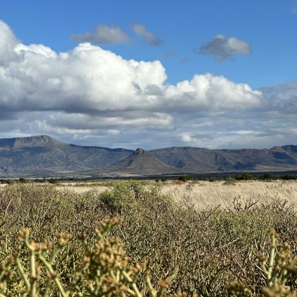
**Hartbeesnek**, 10 kilometres from the settlement, is a mountain neck, the Afrikaans term for a pass or dip through a ridge between hills. Views from the elevated ground stretch across the flat Karoo plains in a way that is difficult to match at ground level, and the name suggests the area was historically significant for hartebeest, one of the large antelope species that once ranged freely across this part of the country.
**Wolwekloof**, 13 kilometres out, is a ravine formation typical of Karoo geology. Kloofs cut sheltered corridors through otherwise exposed terrain, creating micro-environments where plant and animal life differs noticeably from the open veld. Rocky cliff faces above these ravines are regular nesting sites for raptors, and the shadier lower sections support plants that cannot survive on the surrounding plains.
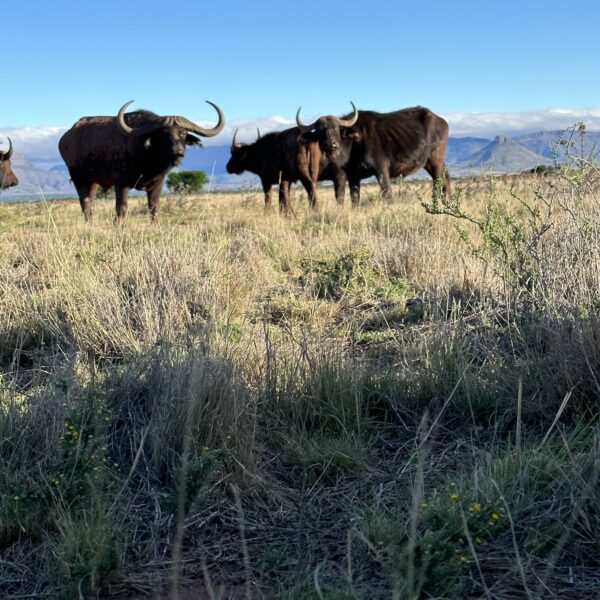
**Grootdam**, 15 kilometres away, is a large farm reservoir. Water concentrates life in the Karoo, and any substantial body of it draws bird species that would otherwise be absent from the dry landscape. Waders, waterfowl, and fishing birds gather at these dams, making them productive stops for anyone interested in the region's birdlife.
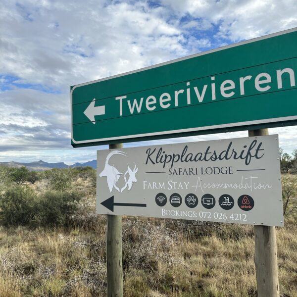
**Tweerivieren**, also 15 kilometres from Bonnyvale, marks a point where two river channels converge. Even in dry seasons the deeper alluvial soils along river lines support denser vegetation, and after rain these confluences become active wildlife corridors worth a deliberate detour.
**Aarbossiesplaat**, 26 kilometres distant, is a flat expanse named for the hardy Karoo shrubs that dominate it. Open plains of this kind provide uninterrupted sightlines across the countryside, including the characteristic koppies that rise from the veld at intervals along the horizon.
**Osberg**, at 28 kilometres the furthest of these destinations, takes its name from the Afrikaans for ox mountain. The elevated ground serves as a useful landmark for orientation across the wider area and rewards the approach with a broad survey of the surrounding countryside.
---
## Planning Your Stay
Accommodation listings for Bonnyvale do not currently appear on mainstream booking platforms. Research requires direct contact with farm properties and guesthouses in the district, ideally several weeks before the intended visit rather than a few days out. Hosts in farming communities manage accommodation around their own operational schedules, and short-notice requests are often not practical.
When comparing properties across the region, ask directly about road conditions between the property and Bonnyvale. Map distances can be misleading when gravel roads are involved, particularly after rain. A property that looks close may take considerably longer to reach than its straight-line distance suggests, and that difference matters when planning day trips.
Before confirming any booking, establish whether meals are included or whether self-catering is expected. The nearest shops require a substantial drive in any direction, and arriving without adequate provisions adds unnecessary difficulty to the trip. It is worth asking too about water supply and power stability, since borehole maintenance schedules and load shedding both affect rural properties across this region.
Groups travelling together manage the logistics of a visit here more easily than solo travellers. Shared accommodation reduces cost per person and allows food, fuel canisters, and emergency equipment to be pooled. Solo travellers should leave a complete itinerary, including property contact details and expected arrival times, with a contact at home, and carry a basic emergency kit in the vehicle.